The Worst River Floods in U.S. History
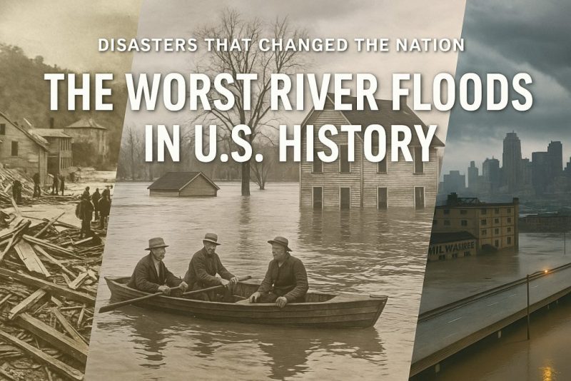
Discover the worst river floods in U.S. history—from the Great Mississippi Flood to Hurricane Harvey—and how they reshaped American landscapes and lives.
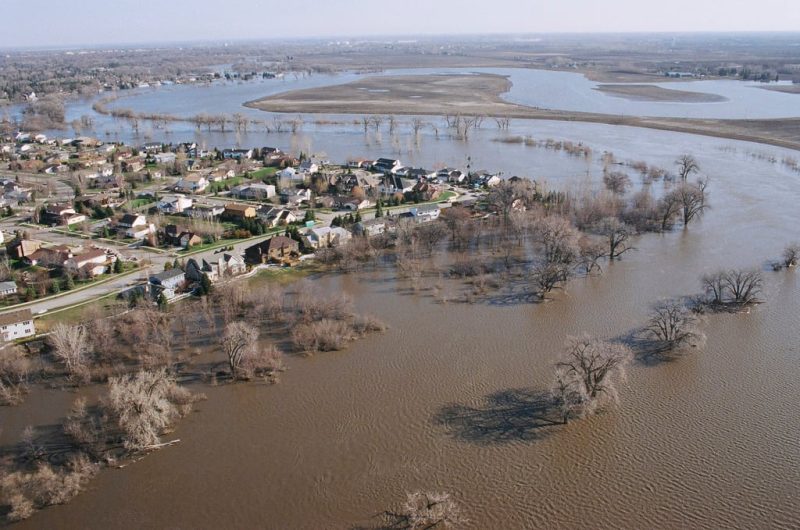
From the swelling Mississippi to the raging Ohio, river floods have carved devastation across the American landscape for centuries. These are not just natural disasters—they are watershed moments that reshaped cities, uprooted millions, and led to sweeping changes in infrastructure and environmental policy. In this post, we look back at the worst river floods in U.S. history, uncovering the causes, the human stories, and the lasting impact of each catastrophe.
Find out more about the floods:
When Rivers Rise: Understanding the Force of Flooding
Learn Why River Flooding Isn’t Always a Disaster—It’s Just Nature Doing Its Job
When Rivers Rebelled: The Worst Floods in Human History
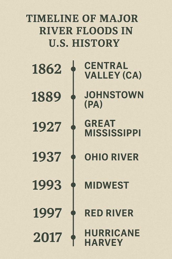
📜 1. The Great Mississippi Flood of 1927
The flood that changed America forever
In the spring of 1927, months of heavy rain overwhelmed levees along the Mississippi River. When the levee broke near Mounds Landing, Mississippi, it unleashed a wall of water that inundated 27,000 square miles across seven states. Over 630,000 people were displaced, mostly African American sharecroppers, and entire towns were swept away.
This flood led to the Flood Control Act of 1928, drastically reshaping how the U.S. Army Corps of Engineers manages rivers. It also played a role in accelerating the Great Migration, as thousands left the devastated South for northern cities.
🌊 2. The Johnstown Flood (1889)
A wall of water and steel
Though technically caused by a dam break, the Johnstown Flood was driven by river overflow—and it remains one of the deadliest in U.S. history. After days of rain, the South Fork Dam above Johnstown, Pennsylvania, collapsed, sending a 40-foot-high wave down the valley.
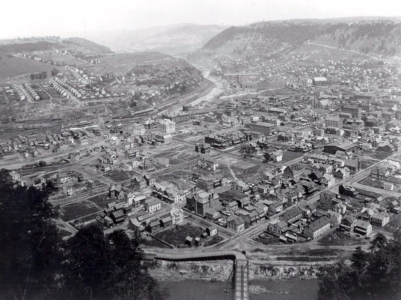
Over 2,200 lives were lost, and the Conemaugh River was transformed into a deadly torrent filled with debris, fire, and destruction. This flood marked a shift in public awareness of infrastructure safety and corporate responsibility.
🌀 3. The Ohio River Flood of 1937
An entire valley underwater
In January 1937, weeks of relentless rain caused the Ohio River to reach record levels. The flood affected nearly every city along the river, including Louisville, Cincinnati, and Evansville. Over 1 million people were displaced, and entire downtowns were submerged.
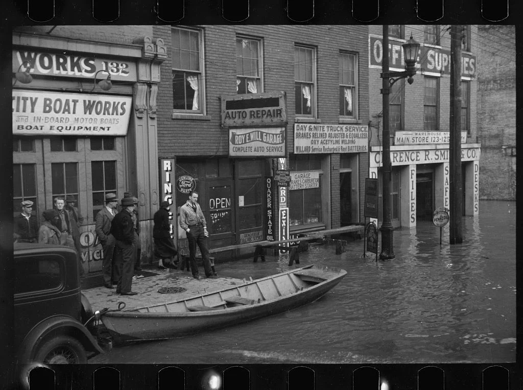
The sheer scale of this flood led to massive investments in floodwalls, levees, and modern flood forecasting systems throughout the Ohio Valley.
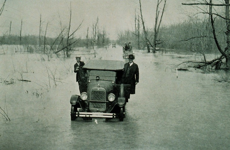
🌧 4. The Central Valley Flood (California, 1861–62)
America’s “Inland Sea” disaster
One of the most overlooked—but catastrophic—floods in U.S. history occurred in California’s Central Valley. Over 43 days of rain turned the Sacramento and San Joaquin rivers into raging torrents, submerging the valley under an inland sea up to 300 miles long and 20 miles wide.
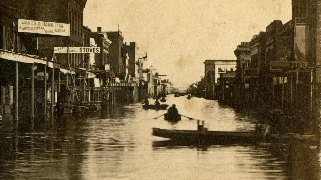
The state capital, Sacramento, was underwater for months. This flood transformed California’s approach to levees, land reclamation, and urban planning—and experts warn it could happen again.
🏙 5. The Great Midwest Flood of 1993
The costliest inland flood in U.S. history
Spanning nearly three months, the 1993 Midwest Flood affected nine states along the Mississippi and Missouri Rivers. The water rose slowly, but relentlessly, breaking through levees and drowning towns across 30,000 square miles.
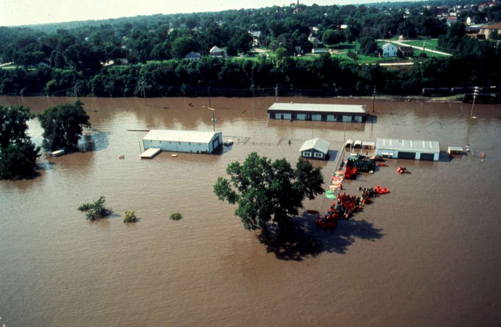
This flood caused over $15 billion in damage, displaced over 50,000 people, and led to sweeping changes in FEMA policy and disaster response planning.
☔ 6. Hurricane Harvey and the Houston Floods (2017)
Modern infrastructure meets historic rainfall
Though caused by a hurricane, the flooding of Houston was largely a river disaster. Over 60 inches of rain fell in just a few days, turning Buffalo Bayou and other rivers into destructive inland seas. Over 100,000 homes were flooded, and recovery is still ongoing.
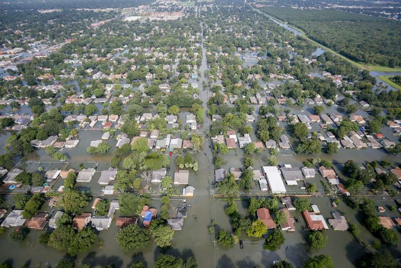
Harvey redefined how we think about “100-year floods” and raised questions about urban sprawl, drainage planning, and climate resilience.
🏞 7. Red River Flood (1997)
A frozen disaster in North Dakota and Minnesota
Spring melt and ice jams turned the Red River into a churning force of destruction. Grand Forks, ND, was hit hardest, with the downtown area engulfed and thousands evacuated in freezing conditions.
In response, a monumental flood diversion project was eventually constructed, known as the Red River Floodway, hailed as one of North America’s top flood protection systems.
🌦 What Causes These Historic Floods?
🌦 What Causes These Historic Floods?
Behind every catastrophic river flood lies a chain of natural forces and human decisions, sometimes working together, sometimes colliding with tragic consequence. Many of the worst floods in U.S. history were born from prolonged and unrelenting rainfall—like the Great Mississippi Flood of 1927 or the Ohio River flood of 1937. In those cases, the skies opened for weeks, and swollen rivers had nowhere left to go. Levees cracked. Lowlands disappeared. Water claimed the land with slow, unstoppable power.
In colder climates, the danger takes a different form. The Red River Flood of 1997 was the result of rapid snowmelt coupled with thick ice jams. As the spring sun arrived too quickly, melting snow surged into frozen rivers that couldn’t move. The water had no choice but to spill over—flooding cities like Grand Forks in the dead of night, in freezing temperatures, under a sheet of black ice and fire.
Sometimes, the cause is human hubris. The infamous Johnstown Flood of 1889 wasn’t caused by weather alone—it was a perfect storm of infrastructure failure and neglect. A poorly maintained dam, weakened by rain, collapsed without warning and sent a wave of water, steel, and fire down the valley. It was a warning about the cost of cutting corners—and it was paid for in over two thousand lives.
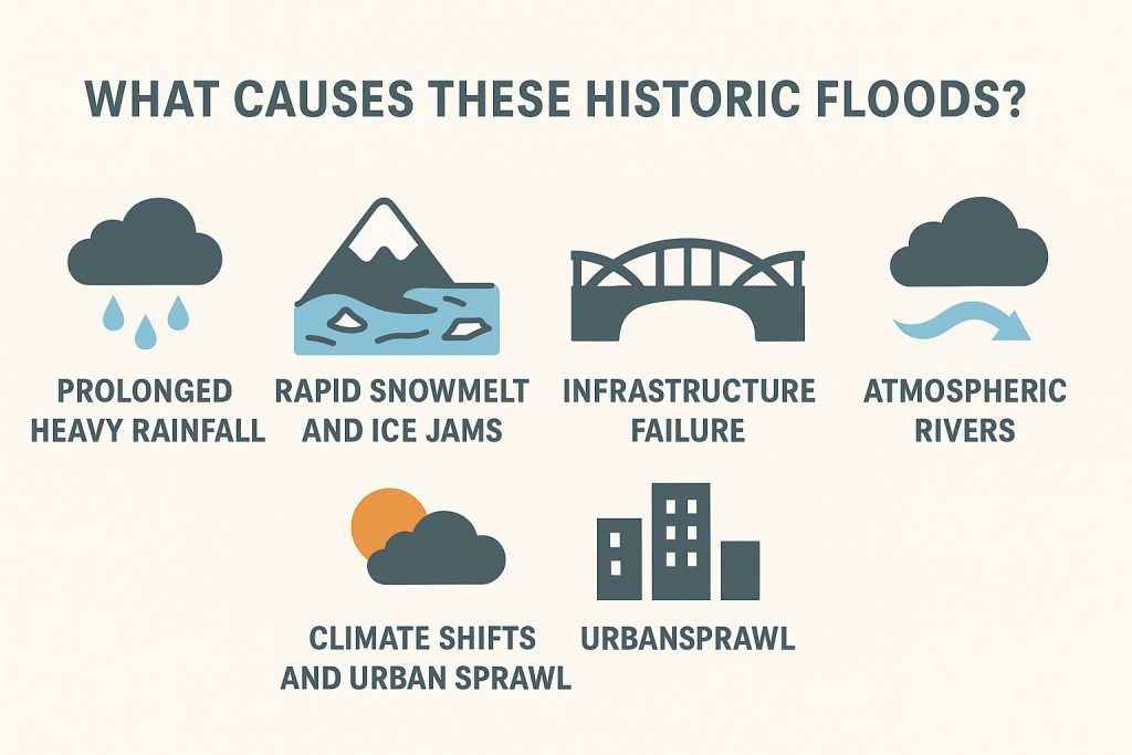
More recently, as cities expand and concrete replaces wetlands, rivers are caged and channeled—until they break free. In 2017, Hurricane Harvey showed how urban sprawl, poor drainage planning, and climate extremes could combine into a nightmare. Houston’s bayous swelled beyond memory, and new neighborhoods sat under six feet of water—neatly paved, but not floodproof.
And in some parts of the West, the sky delivers a different kind of deluge. The Central Valley flood of 1862, still the largest in California’s history, was triggered by what scientists now call an atmospheric river—a long, narrow band of water vapor that dumped rain for 43 straight days. The Sacramento and San Joaquin valleys became an inland sea, submerging towns and scattering settlers across the muddy hills.
These floods weren’t random. They were the result of predictable patterns—sometimes ignored, sometimes misunderstood—and the legacy of each one still lingers, in levees built, cities rebuilt, and lives forever changed.
🧭 Final Thoughts
River floods in the U.S. are not just history—they’re warnings. Each flood revealed the limits of human planning and the power of nature. But they also sparked innovation, legislation, and resilience. As climate change increases the intensity of storms and rainfall, understanding these past floods may help us prepare for the next.
Want to explore more about America’s rivers and natural history? Check out our full series on Rivers of the U.S.