Diyaluma Waterfall Sri Lanka (220m) – Upper Pools, Lower Viewpoint & How to Visit
Visit Diyaluma Waterfall near Koslanda: Sri Lanka’s 2nd-highest waterfall (220m). How to get there, geology, and how to visit the waterfall.
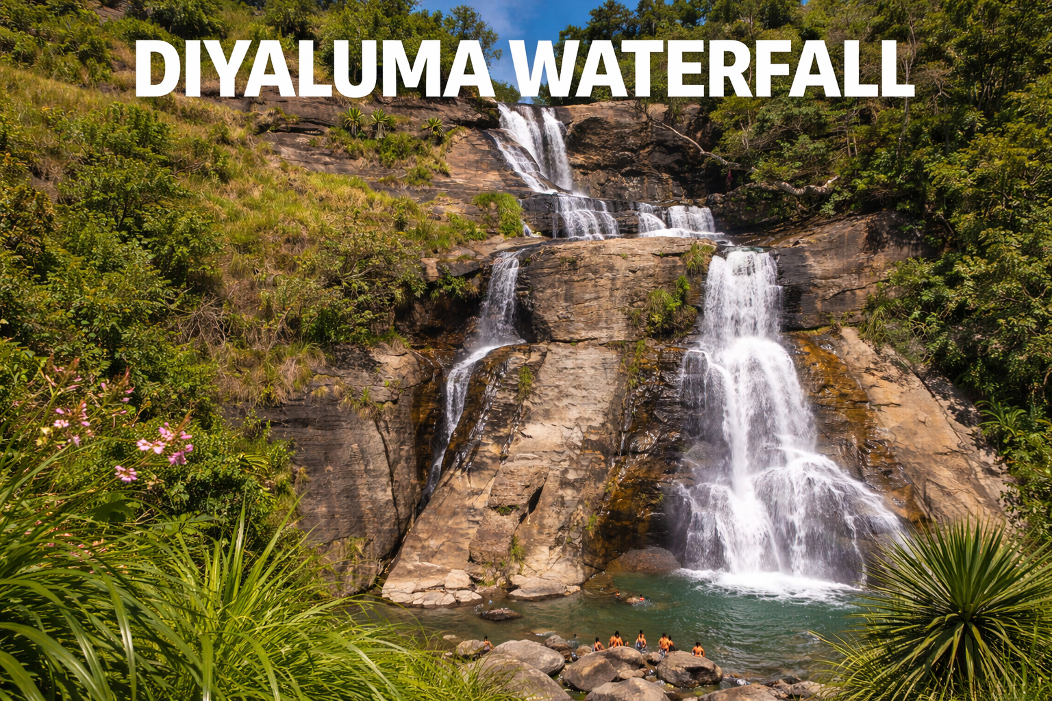
Some waterfalls impress you with noise. Diyaluma seduces with scale — a long, silver ribbon that never fully lets go of the rock as it slides into the valley. At 220 metres, it’s Sri Lanka’s second-highest waterfall, and it earns the title not just through height, but through variety: a dramatic roadside “lower” view… and, higher up, a whole hidden playground of smaller cascades and natural pools carved into stone.
Its name is often translated as something close to rapid flow of water — and sometimes, poetically, liquid light. Once you’re up there, looking over the edge with wind and mist on your skin, you’ll understand why.
Where is Diyaluma Waterfall located?
Diyaluma Falls sits in Badulla District, about 6 km from Koslanda, right off the Colombo–Badulla highway (A4).
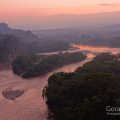
Hydrologically, it’s formed by Punagala Oya, which feeds into Kuda Oya, which then connects into the Kirindi Oya river system — a neat reminder that even “single” waterfalls are really just dramatic moments in a longer river story.

How to get there
By tuk-tuk / car (easiest)
Most travellers base themselves in Ella (or Haputale) and hire a tuk-tuk/car for a half-day trip. Many drivers know both access points (lower bridge stop + upper trailhead).
By bus (budget-friendly)
You can reach the Koslanda area by local buses and then take a short tuk-tuk hop to the falls/turn-offs. Some routes are commonly done via Wellawaya with a transfer.
Geology: why the rock looks the way it does
The landscape around Koslanda/Haldummulla belongs to Sri Lanka’s ancient metamorphic heartland. The region is strongly associated with the Highland Complex, with bedrock that includes charnockitic gneiss and other gneisses/quartzites, shaped by folding, faulting, and long erosion — the kind of geology that creates steep escarpments and clean “drop lines” where rivers suddenly lose altitude.
Those broad, hard rock slabs up top (where the pools form) are essentially nature’s own water-sculpting table: flowing water exploits tiny weaknesses, deepening channels and potholes over time.
What type of waterfall is Diyaluma?
Diyaluma is commonly classified as a horsetail waterfall — meaning the flow stays in contact with the rock for much of its descent rather than free-falling as a single detached plume.
In reality, its personality changes with season: in higher flow it feels wilder and heavier; in drier months it becomes ribbon-like, revealing more of the cliff face.

📚 Want to understand waterfall names?
“Falls”, “cascades”, “tiers”, “horsetail”, “plunge” — the words actually mean different things.
Read the guide: Different Names of Waterfalls →
Lower Diyaluma (near the bridge): the quick, dramatic stop
If you’re short on time, the lower viewpoint near Diyaluma Falls Bridge gives you the “full-height” perspective almost immediately. You’ll often see small stalls nearby (snacks, coconuts), and you can watch the main drop punch into the gorge below.
Best for: photographs of the main cascade, a fast roadside wow-moment, and travellers who don’t want a hike.
Upper Diyaluma: smaller falls, infinity pools, and the real magic
The upper section is where Diyaluma becomes intimate: not one waterfall, but a sequence of smaller cascades and natural pools that step toward the main drop.
How to reach the upper section (the 30-minute trek)
A popular access route starts from Poonagala village (a tea-country settlement above the falls). From there, it’s roughly a 30-minute trek along a footpath through grassland and small patches of the forest leading down toward the upper cascades and pools. Take water to drink.

🎟️ Entrance fee: 350 Sri Lankan Rupees (LKR) per person (usually collected for the Upper Diyaluma trail; bring cash).
What the hike feels like: hot, open, and scenic — then suddenly you hear water before you see it. A few minutes later, the first pools appear, and the cliff-edge drama begins.
Tip: save offline maps; mobile signal can be patchy in the hills.
🏊♀️ Upper Diyaluma: swimming & jumping (only with local guidance)
In the upper section you can swim safely in some of the smaller natural pools — and in a few spots, even jump.
But only do it where local guides (or experienced locals) clearly show you.
The rock can be deceptively slick, currents change fast, and the edges are unforgiving — it’s never worth risking it.
🥥 You’ll also sometimes find local people from the nearby village selling fresh coconuts near the trail/pools — the best kind of “snack stop” after the heat of the trek.

Safety notes (worth reading)
- Avoid after heavy rain. Water levels rise fast, currents get deceptively strong, and rocks turn into glass.
- Wear proper shoes. The trail can be uneven and scratchy in places.
- If you swim, choose calm pools only and keep well back from any lip or channel that feeds the main drop.
🍛 Lunch tip: Poonagala village
Before or after the upper pools, you can stop for a proper countryside lunch in Poonagala.
There are several small, local restaurants with a quiet tea-country feel — and they’re usually very affordable.