Types of River Mouths: Where Rivers Surrender to the Sea
Discover the different types of river mouths—from majestic deltas to winding estuaries—and how rivers shape their final journey into the sea.
Where a river ends its journey is just as fascinating as where it begins. After carving through mountains, meadows, and valleys, a river finally reaches its grand finale: the sea. But not all river endings look the same. From sprawling, fertile deltas to calm, brackish estuaries, the types of river mouths vary dramatically across the world. These diverse endings are shaped by geology, tides, and time—each one telling a different story of water meeting the wide open ocean. Let’s explore the most stunning and scientifically intriguing ways rivers surrender to the sea.
Where the River Meets the Sea
When a river journeys across mountains, plains, and forests, it eventually reaches its destination—the vast expanse of the ocean. But that final embrace is far from uniform. The shape and character of a river’s mouth—where its freshwater flow yields to the salty rhythms of the sea—are not carved by water alone. They are sculpted by a symphony of forces: climate, tidal energy, sediment load, wave action, and the geological shape of the coastline itself.
In some places, rivers fan out into lush, sediment-laden deltas that build land outward into the sea. In others, they slip into the ocean through narrow tidal inlets, winding rias, or steep-sided fjords. Each type of river mouth tells a geological and ecological story, reflecting the land it traverses and the sea it encounters.
Let’s explore the main types of river mouths and see how rivers meet the sea in dramatically different ways across the globe:
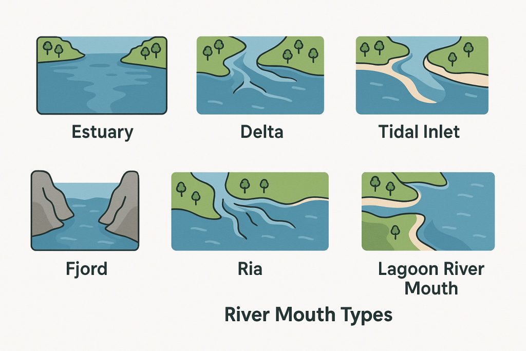
Estuary – Where Waters Blend
Estuaries are semi-enclosed coastal bodies of water where freshwater from rivers mixes with saltwater from the sea, creating a brackish, ever-shifting environment. These are often formed when rising sea levels flood ancient river valleys, especially after the last Ice Age. The result is a landscape constantly shaped by tides and currents—rich in nutrients, teeming with life, and critical for coastal ecosystems.
Read more about estuaries
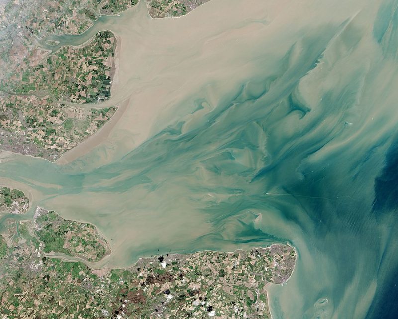
🐚 Example: The Thames Estuary in England has long served as a gateway to London and is a vital habitat for birds and fish.
🌁 Example: San Francisco Bay in California is a classic tectonic estuary, formed by the subsidence of land along fault lines, then flooded by the sea.
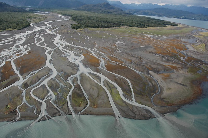
Delta – Land Built by Water
In contrast to estuaries, deltas form when a river slows and spreads out, depositing its sediment load at the mouth. Over time, these sediments accumulate to form flat, fertile landforms, often branching into a maze of distributaries. Deltas usually form in low-energy coastal areas where the sea doesn’t wash the sediments away too quickly.
🌾 Example: The Nile Delta, an ancient cradle of civilization, fans out across northern Egypt, creating fertile farmland where desert meets the Mediterranean.
🌊 Example: The Ganges-Brahmaputra Delta in Bangladesh and India is the world’s largest delta an one of its most densely populated regions.
🐊 Example: The Mississippi River Delta in the USA is a bird-rich wetland under threat from rising seas and shrinking marshes.
Read more about deltas
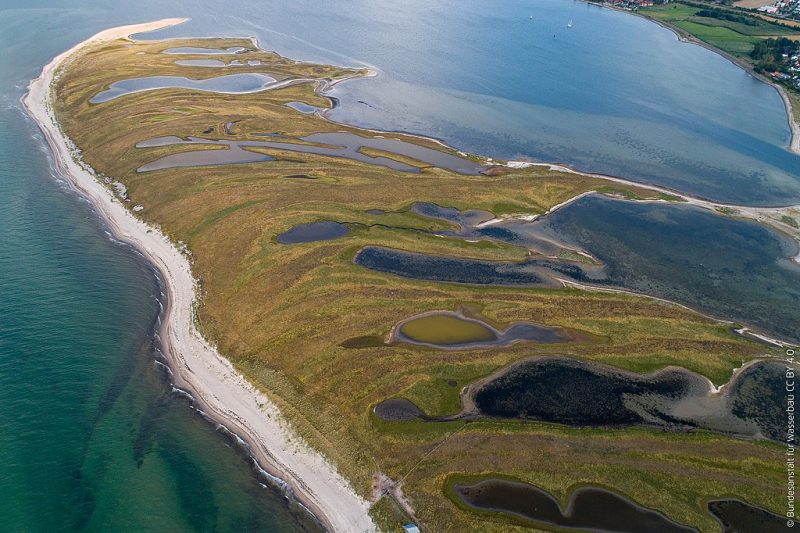
Tidal Inlet – A Shifting Mouth of Sand and Sea
In places where rivers meet the sea along sandy or low-lying coasts, their mouths may take the form of tidal inlets—narrow, often temporary channels that shift with tides and storms. These mouths are frequently bordered by barrier islands or sandbars, and may even close off temporarily, only to be breached again by flooding rivers or powerful tides.
🏖️ Example: The Outer Banks in North Carolina are lined with such tidal inlets, constantly changing due to hurricanes and shifting sands.
🌬️ Example: Lagoons in southern Mozambique form behind long sandbars with seasonal inlets that open and close with the rains.
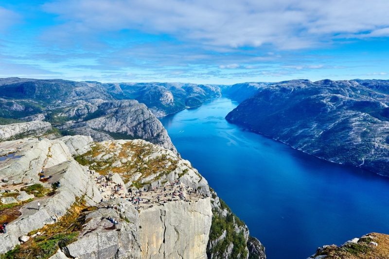
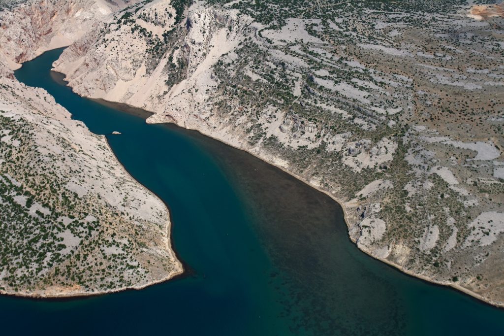
Fjord – Glacially-Carved Majesty
Fjords are deep, narrow inlets created by glaciers that gouged out steep valleys, later flooded by the sea. Rivers may still flow into these dramatic basins, often contributing freshwater to a system dominated by steep cliffs, cold waters, and limited sediment.
❄️ Example: Milford Sound in New Zealand is a stunning fjord where waterfalls plummet from sheer rock faces into dark, deep waters.
🧊 Example: Sognefjord in Norway, the longest and deepest fjord in the country, receives glacial melt and river flow from inland mountains.
Ria – Drowned River Valleys
Rias are drowned river valleys similar to fjords, but with gentler slopes and less dramatic relief. Formed when rising sea levels inundate coastal river valleys, they tend to be long, branching, and influenced by tides and marine sediment.
🌊 Example: Rías Baixas in Galicia, Spain are known for their scenic coastlines and rich seafood fisheries.
🛶 Example: Poole Harbour in southern England is a ria estuary, wide and shallow, with numerous inlets and saltmarshes.
Lagoon River Mouth – Between River and Sea
In flat coastal regions, rivers may empty into coastal lagoons before reaching the sea. These mouths often involve indirect or delayed contact with the ocean, separated by barrier islands or narrow channels. The result is a calm, shallow environment with low tidal energy, often rich in fish and birdlife.
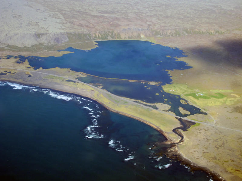
🌿 Example: The Kerala Backwaters in India are a labyrinth of brackish lagoons and canals, fed by rivers and connected to the sea through narrow inlets.
🌅 Example: The Danube Delta near the Black Sea includes multiple lagoon systems along its edge.
Straight Coastal Outflow – Fast and Direct
Some rivers—especially in steep, mountainous coastal regions—flow directly into the sea without forming deltas or estuaries. These mouths often exist in high-energy environments where strong waves or steep slopes prevent sediment buildup.
🌋 Example: Many rivers on volcanic islands like those in Hawaii or Indonesia plunge directly into the sea after a short, steep descent.
🌧️ Example: Chilean rivers along the Pacific coast also often meet the ocean abruptly, especially in the southern Andes region.
In Summary
From tidal estuaries to sediment-rich deltas, narrow fjords to winding rias, rivers have many ways of surrendering to the sea. These mouth types are shaped not only by the flow of water but by millions of years of the Earth’s movement, climate shifts, and coastal dynamics. Each one is a storybook of geological history—a final chapter of a river’s journey that opens into the grand narrative of the ocean.