Tumpak Sewu Waterfall: Java’s “Thousand Falls” in a Volcanic Amphitheater
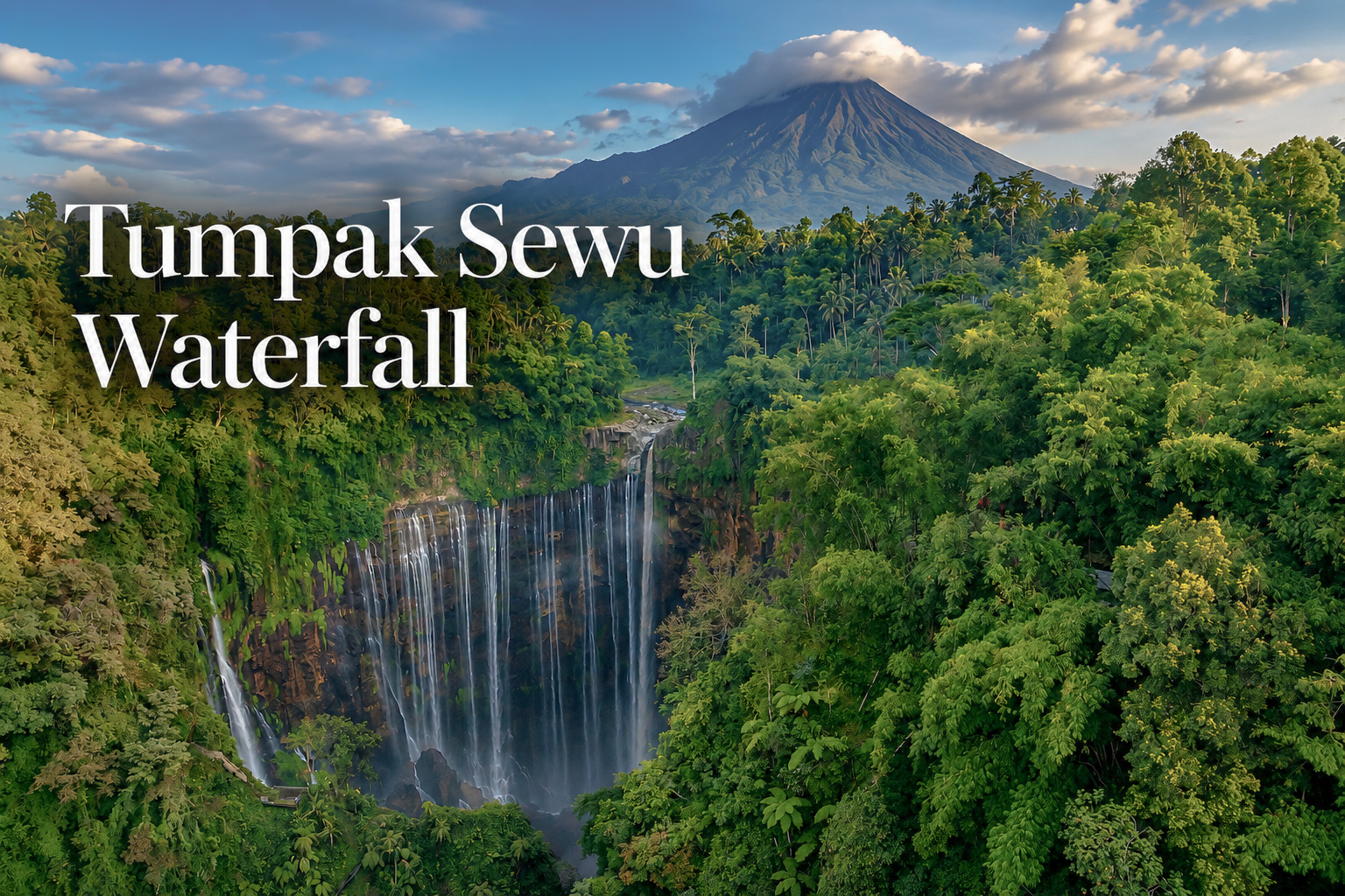
One of Earth’s most spectacular waterfalls: Tumpak Sewu, a semicircle of cascades in a deep amphitheatre on Semeru’s volcano flank, East Java.
Tumpak Sewu—often called Coban Sewu—sits on the Lumajang–Malang border in East Java, where the landscape carries Mount Semeru’s volcanic signature. The waterfall’s most recognizable trait is its shape: a wide, curved escarpment that turns falling water into a near-amphitheater, a curtain rather than a column.
What looks like one “iconic waterfall” from above is, in reality, a whole hydrological scene: a main river dropping into the canyon and many additional streams appearing from the rock face and side gullies—especially dramatic in the wet season.
Geology of Tumpak Sewu: Semeru’s layers, cut open
The canyon around Tumpak Sewu is widely described as a product of Semeru’s volcanic activity, where lava and pyroclastic materials accumulated and were later carved by erosion into steep, curved walls. That curved wall is the stage: it’s what allows the water to “spread” across a semicircle rather than being forced into one narrow chute.

Semeru’s volcanic systems also matter because they continuously supply loose material—ash, sand, and fragmented rock—that can be remobilized by rainfall. On active volcanoes, that relationship between “fresh deposits” and “heavy rain” is a known recipe for fast-moving sediment-laden flows (lahars) in river valleys.
So when you’re looking at Tumpak Sewu, you’re seeing a landscape that is not only eroded by water, but also periodically reset by volcanic sediment moving through the same drainage lines.
Waterfalls are more than a scenic drop in a river — they’re living geology in motion, shaping cliffs, canyons, and entire river landscapes. If you want the bigger picture, start here.
Waterfalls: Nature’s Most Magnificent TreasuresHydrology: one river, many waterfalls
The main flow: Kali Glidik (Glidik River)
Tumpak Sewu is described as an upper reach (hulu) of Kali Glidik, draining the southern slopes of Semeru. From the Tumpak Sewu area, the Glidik River continues south and eventually meets other flows before reaching the Indian Ocean coast.
This is the backbone of the system: the part that behaves like a “classic river waterfall.”

Why it looks like “a thousand falls”
The name Tumpak Sewu is commonly explained as “waterfalls piled up” or “a thousand waterfalls,” pointing to the way water appears in many parallel strands along a curved cliff.
Hydrologically, this look usually happens when:
- the cliff face is broad and segmented (so water can exit at multiple points),
- the rock is fractured and layered (creating many small pathways),
- and groundwater / seepage emerges along contacts in the rock, adding thin “ribbons” beside the main flow.
In other words: it’s not just one river plunging—it’s also a lot of smaller flows joining the spectacle as they find their own exits from the canyon walls.

Rainy season: the “creamy” river vs clearer side streams
In the rainy season, observers often notice a strong color contrast: the main river-fed section can turn brown or creamy, while some smaller side streams remain clearer. That difference makes sense in a volcanic catchment.
When heavy rain mobilizes ash and loose sediment upstream, the river quickly carries suspended material—turning the water opaque and “milky-brown.” This effect is not hypothetical at Tumpak Sewu: reports have documented rain-triggered lahar/flash-flood events in the Glidik River that made the waterfall’s flow turn visibly brown and surge in volume.

Meanwhile, the thinner streams that appear from the cliff sides can be less turbid at the same moment—especially if they are fed by local seepage or small catchments that aren’t flushing the same volume of sediment.
Tumpak Sewu is featured on our curated list of the planet’s most beautiful waterfalls — a reminder that this “thousand-falls” amphitheatre belongs among the great icons of moving water.
See the full listThe canyon’s side-waterfalls: Goa Tetes and the “wet walls” effect
Tumpak Sewu’s canyon isn’t a single viewpoint; it’s a corridor of water features. One of the best-known is Goa Tetes, a nearby spot often visited as part of the same area, where water doesn’t only plunge—it drips, sheets, and beads across rock in smaller cascades and damp alcoves.
Goa Tetes is frequently described through its atmosphere: slippery stone, constant droplets, and a sense that the cliff is leaking rather than “flowing.” That texture is part of what makes the region feel less like a single attraction and more like a water system in multiple forms.

Small caves on the slopes: Goa Bidadari
Along the route toward the base, Goa Bidadari is often mentioned as a small cave stop in the same complex. Local tourism writing places it not far from the main descent and notes a tradition of the cave being used for quiet spiritual practice (meditation/retreat), with clear water flowing out near the entrance into a small pool.
Even if you approach it without any spiritual intent, it adds an important layer to the place: Tumpak Sewu isn’t only “water + rock.” It’s also micro-spaces—cave mouths, wet ledges, shaded pockets—where the canyon becomes intimate.

Meaning for local people: names, beliefs, and canyon folklore
Tumpak Sewu’s identity is deeply tied to the way it looks. The very name, as explained in local government writing, emphasizes the idea of many waterfalls gathered together—a direct reflection of the curtain-like structure.
Around the wider area, there are also circulating local beliefs—shared through popular travel media—such as the idea that water at Goa Tetes is connected with “awet muda” (staying youthful). It’s best treated as folklore rather than fact, but it matters culturally: it shows how people translate a dramatic water landscape into meaning, ritual, and story.

Tourism today: a national icon, managed locally, shaped by risk
Tumpak Sewu has grown into one of East Java’s flagship nature destinations, and its management is strongly linked to local governance and community structures. The Lumajang Regency government has noted coordination through Desa Sidomulyo and its BUMDes (village-owned enterprise) for the management of Tumpak Sewu and nearby sites like Goa Tetes.
Academic work on the site also frames Tumpak Sewu’s approach as community-based tourism, with local participation central to operations and visitor services.

But the canyon’s beauty comes with real hydrological reality: it is a drainage channel on an active volcano’s flank. Reports of lahar/flash-flood surges through Kali Glidik—sometimes occurring even when it isn’t raining right at the waterfall—highlight why “water color and river sound” aren’t just aesthetics here; they can be early signals.
Tumpak Sewu today is, in a sense, two stories at once:
- a highly photogenic amphitheater waterfall that draws visitors from across Indonesia and abroad, and
- a living volcanic watershed where rain, ash, and river dynamics can change conditions quickly.