Understanding River Regimes
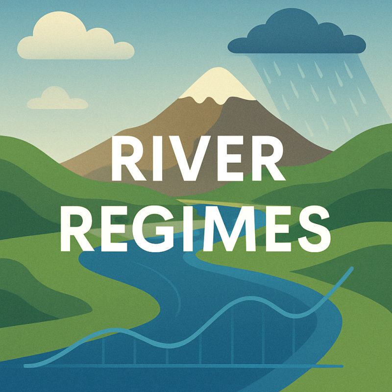
Explore the different types of river regimes, their causes, and impacts on ecosystems, floods and human activities.
Rivers are not just bodies of water; they are living systems with rhythms, patterns, and pulses as ancient as the landscapes they traverse. One of the most vital, yet often overlooked, aspects of a river’s behaviour is the river regimes—the seasonal pattern of its flow throughout the year.
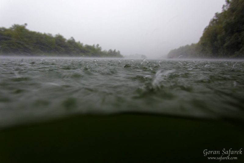
A river regime is more than a hydrological chart. It’s the river’s heartbeat, shaped by snowmelt, rainfall, glaciers, and droughts. It tells us when the waters will rise, when they will retreat, and how ecosystems will bloom or brace in response. From the quiet trickle of alpine streams to the thundering rise of monsoon-fed deltas, the regime determines the timing and severity of floods, the distribution of nutrients, and the survival of entire ecosystems.
Every species that depends on the river—fish, birds, plants, even human communities—tunes its life cycle to the rhythms of this watery clock. Farmers plant according to flood patterns, wetlands breathe in sync with seasonal surges, and engineers build dams hoping to predict the unpredictable.
But not all river regimes are the same. Some follow simple, predictable paths, while others reflect complex interactions between snow, rain, and geography. And as climate change reshapes seasons and rainfall patterns, these regimes are shifting—sometimes subtly, sometimes with devastating consequences.
To understand a river’s regime is to understand its story: its past, its present, and the forces that may shape its future.
💧 What Is a River Regime?
A river regime is the distinct pattern of a river’s discharge—or flow rate—measured at a specific point over the course of a year. This pattern reflects how much water flows through the river during different seasons, and it often repeats itself cyclically, like the natural pulse of the landscape. Some rivers rise in spring and fall silent in summer; others surge multiple times a year or flow steadily with minimal variation.
River regimes are not random. They are shaped by a complex interplay of factors, including climate, topography, geology, land cover, and human influence. Each element affects how, when, and how much water reaches the river.
-
In cold regions, snow and ice dominate the rhythm, releasing meltwater in dramatic spring flushes.
-
In tropical climates, rainfall may drive a single, intense peak—especially during monsoon season.
-
In equatorial zones, with two rainy seasons, rivers may have multiple peaks and less pronounced lows.
-
And in areas with human-altered watersheds, such as cities or dammed valleys, the natural flow may be suppressed or reshaped entirely.
Understanding a river’s regime is essential because it affects everything downstream: the frequency and intensity of floods, the availability of freshwater for agriculture and urban use, the ecological lifecycles of aquatic and riparian species, and even the timing of sediment transport that builds deltas and nourishes floodplains.
River regimes also determine how we plan and adapt. Engineers use regime data to design dams and reservoirs. Farmers rely on it to time planting and harvesting. Conservationists study it to protect fish spawning grounds and migratory bird habitats. And in an era of increasing climate instability, understanding river regimes is more urgent than ever.
They are not just hydrological curves—they are maps of memory and movement, shaped by centuries of water flowing through stone, forest, ice, and earth.
Types of River Regimes
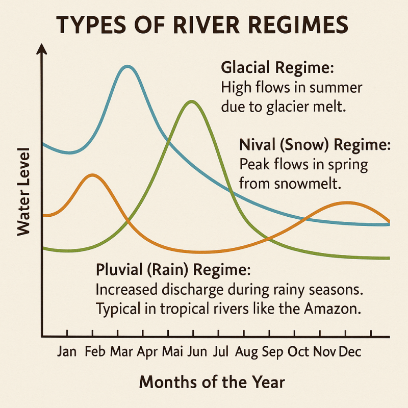
Simple Regime
Characterized by a single peak and trough in discharge annually, simple regimes are typically influenced by one dominant factor:
-
Glacial Regime: High flows in summer due to glacier and melt. Common in rivers like the Rhône in Switzerland.
-
Nival (Snow) Regime: Peak flows in spring from snowmelt. Observed in rivers such as the Volga in Russia.
-
Pluvial (Rain) Regime: Increased discharge during rainy seasons. Typical in tropical rivers like the Amazon.
Complex Regimes
These regimes exhibit multiple peaks and troughs, resulting from a combination of factors:
-
Nivo-Pluvial Regime: Primary peak from snowmelt and a secondary peak from rainfall. Seen in rivers like the Danube.
-
Pluvio-Nival Regime: Main peak due to rainfall, with a secondary peak from snowmelt. Common in rivers such as the Mississippi.
-
Equatorial Regime: Multiple peaks corresponding to rainy seasons, as in the Congo River.
🌦️ What Influences River Regimes?
The behavior of a river—its rises and falls, its sudden floods and gentle flows—is shaped by a wide range of natural and human-driven factors. At the heart of every regime is climate, which determines precipitation patterns and temperature fluctuations throughout the year. In monsoonal regions, rivers often experience dramatic seasonal changes, swelling with torrential rains and retreating during dry spells. In contrast, equatorial regions receive more consistent rainfall, leading to more uniform river discharge across the calendar.
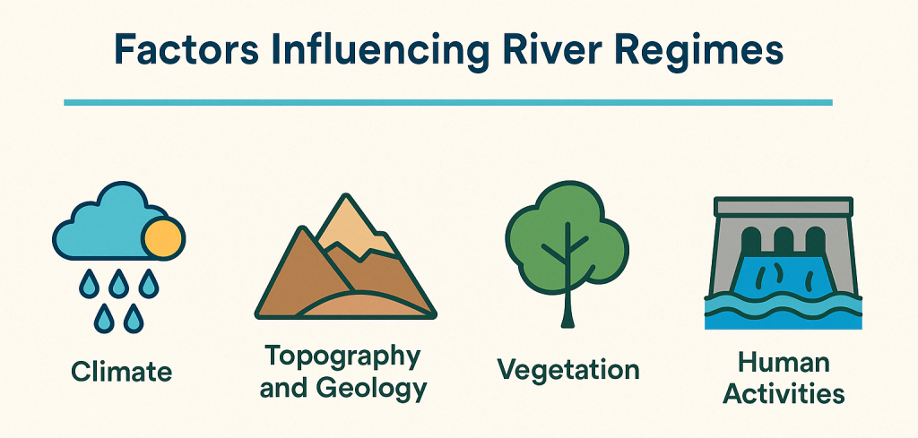
Topography and geology also play critical roles. Mountainous regions tend to generate rapid runoff, especially when snow begins to melt in spring. Rivers in these areas often surge quickly, fed by steep gradients and fast-moving tributaries. The underlying rock and soil—whether porous and absorbent or compact and impermeable—determine how much water is stored underground and how much rushes to the surface, altering the timing and volume of river flow.
The surrounding vegetation influences the regime too. Dense forests and wetlands act like natural sponges, absorbing rainwater and gradually releasing it into rivers. This slows the flow and reduces flood risks. But when forests are cleared, water speeds across the surface instead, intensifying discharge and making floods more severe. In this way, deforestation can reshape an entire river’s behavior.
Of course, not all changes come from nature. Human activities can significantly disrupt or modify river regimes. The construction of dams and reservoirs alters the timing and magnitude of flow, often suppressing natural peaks and starving downstream ecosystems of seasonal floods they depend on. Urban development replaces natural land with concrete and asphalt, reducing infiltration and sending stormwater rushing into rivers in dangerous surges. Even irrigation systems can divert water away from natural channels, flattening the river’s pulse into an artificial rhythm.
🧭 Why River Regimes Matter
Understanding how a river flows—and why it flows that way—is essential for sustainable living and long-term planning. In water resource management, knowing a river’s regime helps balance the needs of agriculture, industry, and local populations, especially in regions where water is scarce or demand is growing.
River regimes also inform flood prevention strategies. By recognising when a river is likely to peak, communities can build smarter defences, issue timely warnings, and reduce the devastating impact of sudden inundation.
Perhaps most importantly, river regimes are key to ecosystem conservation. Many aquatic species time their reproduction cycles with seasonal floods. Migratory fish rely on changes in flow to reach breeding grounds. Wetlands breathe in sync with the river’s pulse. When that pulse is altered, the entire ecosystem can falter.
🌍 Real-World Examples
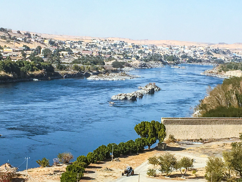
Take the Nile River, for instance. It exhibits a complex regime, shaped by rainfall in both the Ethiopian Highlands and the equatorial lakes. Its seasonal floods have nourished Egyptian agriculture for millennia, creating one of the oldest continuous civilizations on Earth.
Meanwhile, the Ganges River in South Asia is driven primarily by a pluvial regime. It swells dramatically during the monsoon season, affecting the lives and livelihoods of millions. Understanding the Ganges’ flow is not just a scientific pursuit—it’s a matter of survival.
Conclusion
River regimes are fundamental to understanding the behaviour of rivers and their interaction with the environment and human societies. By studying these patterns, we can better manage water resources, protect ecosystems, and prepare for natural events like floods and droughts.