River morphology – how does river look like?
Rivers are very diverse bodies of the water. Flow from the hills to the plains in different forms. River morphology describes how does river look like.
We have already defined what a river is. The river (or a stream in general) is a body of freshwater (with some exceptions) that flow in one direction (downstream). Read more
Now, he can see how does the river look like, or what is a river morphology. The terms river morphology is used to describe the shapes of river channels and how they change in shape and direction over time. Similar is hydromorphology that describes the shape of all water bodies on Earth.
A river usually stays in its channel, a long, narrow depression eroded by the stream into rock or sediment. The river banks are the sides of the channel; the riverbed is the bottom of the channel. During a flood, the waters of a river may rise and spill over the banks onto the flat floodplain of the valley floor.
This image shows a longitudinal profile of a typical stream viewed from the side.
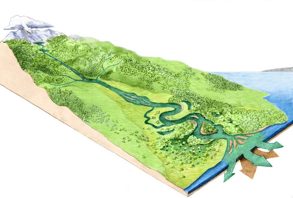
The river begins in steep mountains and flows out across a gentle plain into the sea. The headwaters of a river are the upper part of the stream near its source in the mountains. On a foothill or sloped lowland, is the middle course of the river. The river often flows in the broad valleys, often in a braided stream. River deposits lots of sediment in a wide riverbed. In a dry part of the year, there is no main channel, but many, cutting through the thick sediment layer. In plains, the river is meandring, easily eroding the floodplain of its own sediment that has deposited for a very long time.
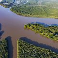
The mouth is the place where a river enters the sea, a lake, or a larger river. The mouth could be an estuary or a delta. A river delta is a triangular river mouth with several branches. The delta is formed by the silt and terrain carried by the river flow along the river, and it little by little lengthens the flow of the river towards the sea. An estuary is a river mouth that resembles a funnel and which widens, deepens and opens toward the sea. The rule of thumb is that where there is a noticeable tide, the rivers form estuaries: where it is little or no tide, rivers form deltas.
Bear in mind that there are so many exceptions, depending on geology and other factors.
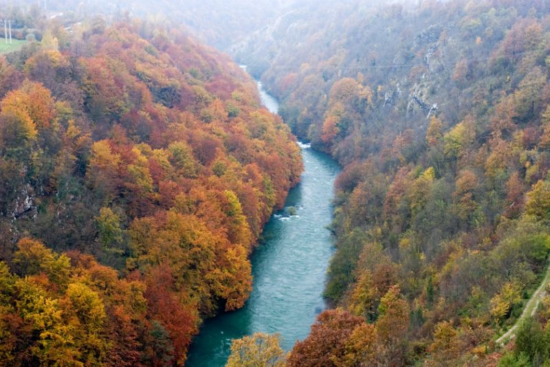
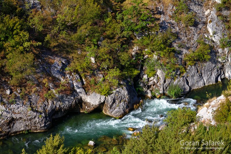
A cross section of a stream in steep mountains is usually a V-shaped valley cut into solid rock, with the stream channel occupying the narrow bottom of the valley. There is little or no flat land next to the stream on the valley bottom. Then, there are canyons. Often the terms canyon valley and the canyon are used interchangeably, but most geologists will tell you the major difference between them is that canyons are deeper, more narrow and with steep sides. In the plains, the river is „flat“, and the channel is actually its own sediment. A river usually flows within a broad, flat-floored valley.
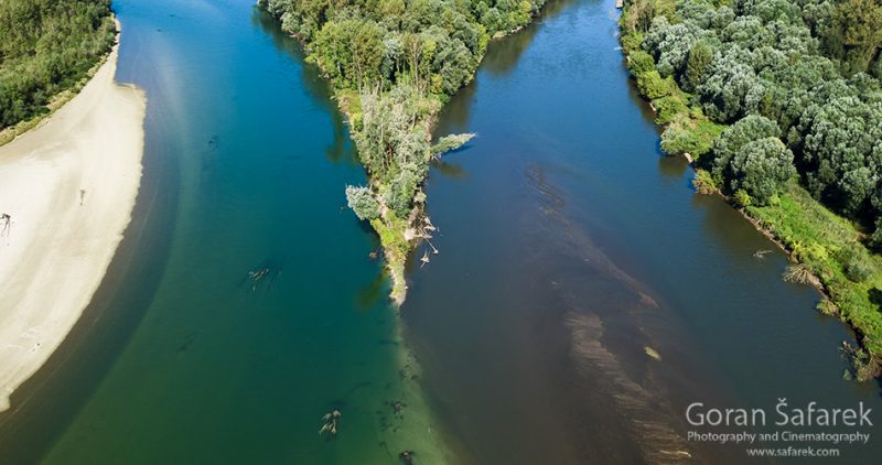
The river channel is surrounded by a flat floodplain of sediment deposited by the stream. In a floodplain, side branches (sidearms) branches off and flows away from the main stream channel. They are a common feature of river deltas. They could be physically cut from the main channel and become a dead arm or a backwater – a stagnant water turning to a marsh. An oxbow lake is a U-shaped lake that forms when a wide meander from the main stem of a river is cut off, creating a free-standing body of water. Learn how such a dynamic river is key to biodiversity.
The river banks are the sides of the channel; the riverbed is the bottom of the channel. During a flood, the waters of a river may rise and spill over the banks onto the flat floodplain of the valley floor
As mentioned above, the stream deposits the sediment. Stream deposits may take the form of a bar, a ridge of sediment. Usually, sand and gravel, deposited in the middle or along the banks of a stream. In the case of the meandering river, we speak of the point bars, inside of curves because of the lower velocity there.
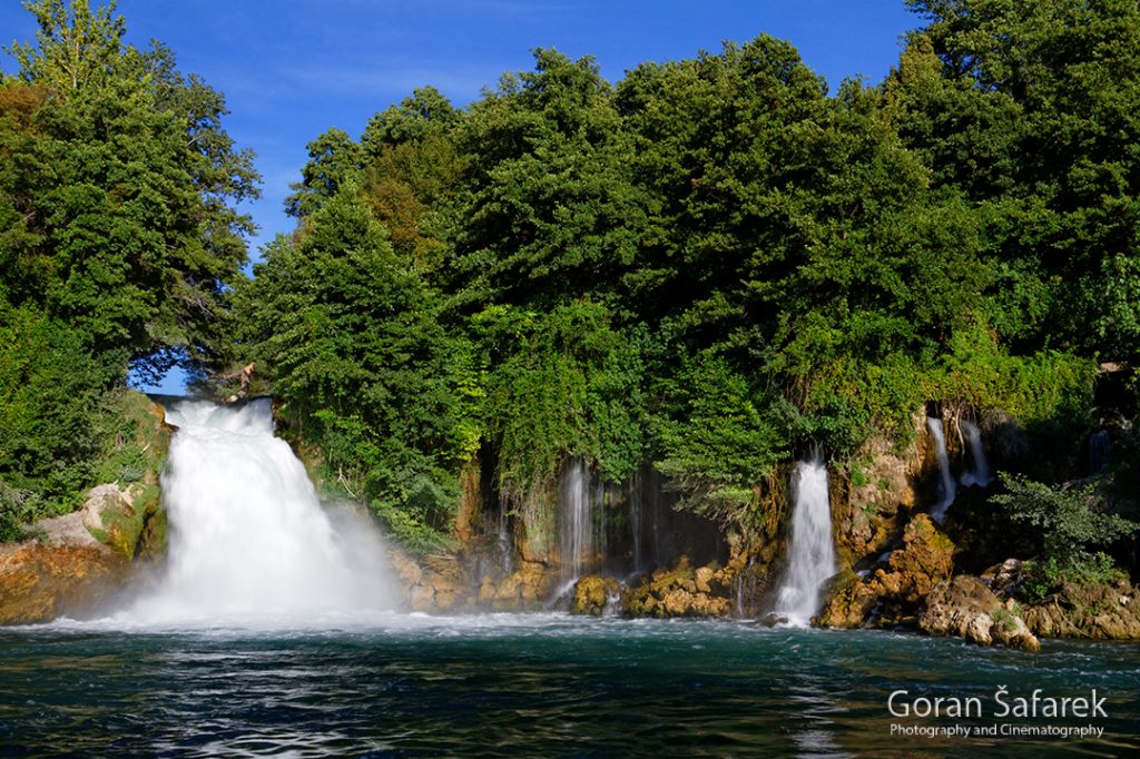
Rivers can flow smoothly (runs), in rapids and in cascades. River in the upper reaches is fast, flowing through large rocks and boulders, and often we find rapids. As flowing water splashes over and around the rocks, air bubbles become mixed in with it and portions of the surface acquire a white color, forming what is called “whitewater“(See rapid classification). A waterfall is a place where water flows over a vertical drop or a series of steep drops in the course of a stream or river. It could be also a result of a barrier (natural or artificial) across the channel.